5,000 homes below a Site of Special Scientific Interest
Thurrock Council's Local Plan allocates about 250 hectares of Green Belt for a new settlement of 5,000 homes (Policy SS18), directly below Langdon Ridge SSSI. As a resident of the adjoining lane and lead of the Protect Langdon campaign, I applied the Evidently method to test the allocation against the Council's own evidence, inside a six-week consultation.
A matter of my own, as campaign lead. Evidence analysis, not legal advice. Representation filed 14 October 2026. The Council has since published an updated habitats assessment and extended the consultation to 10 November 2026. Supplementary representation dated 10 November 2026.
Bluebell woods, Red List birds and protected reptiles
The Council carried out no ecological survey on the SS18 land. Natural England's records for Langdon Ridge SSSI, and residents' records over many years, show what lives on it and beside it. None of these species is named in any Council document for the allocation.
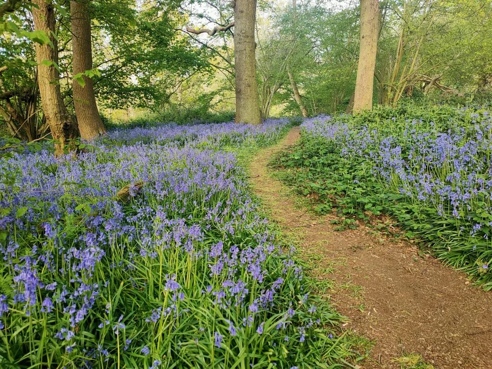
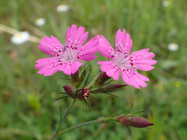
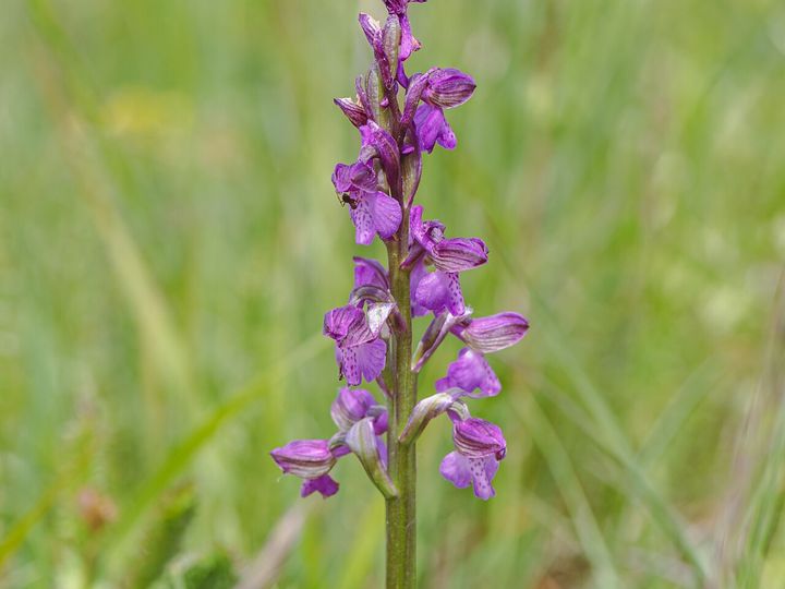
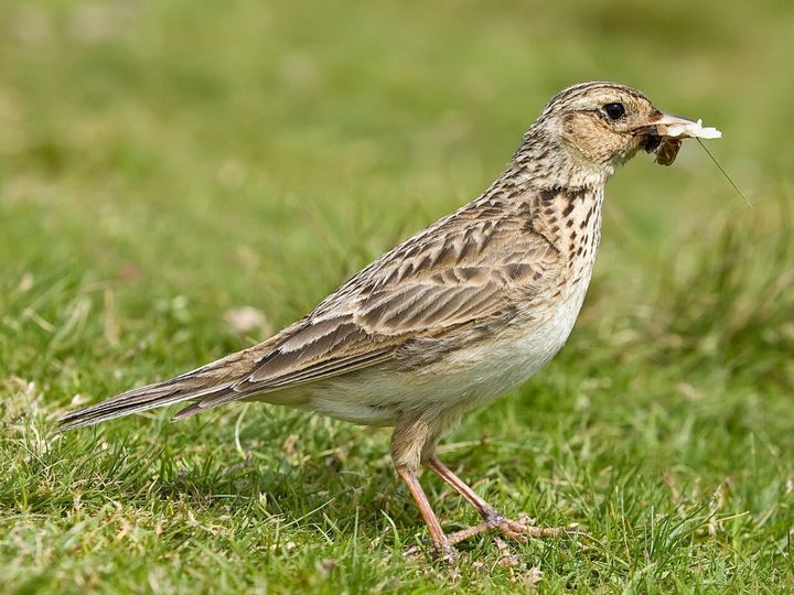
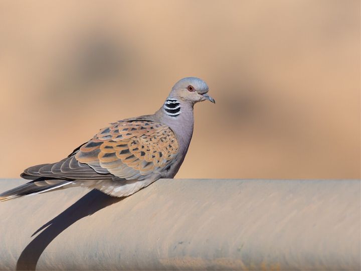
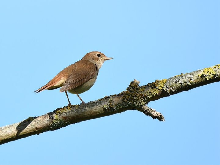
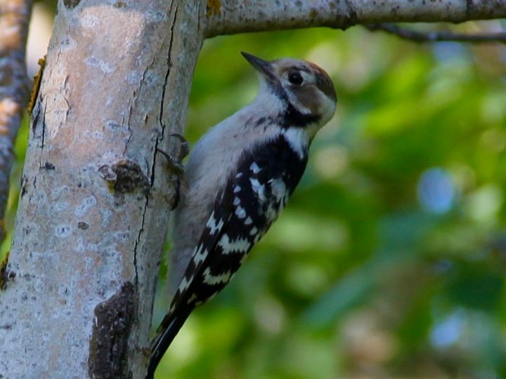
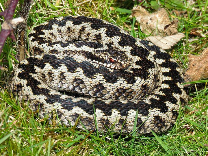
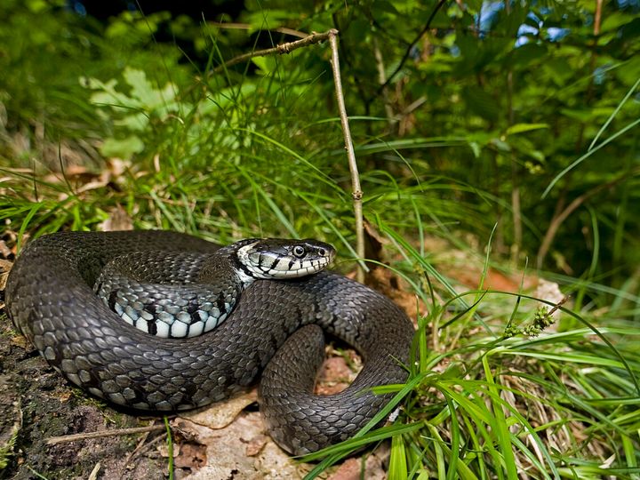
Sources: our representation, section 4.6 and Appendix D (residents' records); Natural England, Langdon Ridge SSSI citation and supporting information, as cited there. Species photographs show each species; they were not taken at Lower Langdon. From Wikimedia Commons: Deptford Pink, Krzysztof Ziarnek (Kenraiz), CC BY-SA 4.0; Green-winged Orchid, Flocci Nivis, CC BY 4.0; Skylark, Diliff, CC BY-SA 3.0; Turtle Dove, El Golli Mohamed, CC BY-SA 4.0; Nightingale, Romzig, CC0; Lesser Spotted Woodpecker, Матвей111, CC0; Adder, Sam Thomas, CC BY 2.0; Grass Snake, Benny Trapp, CC BY-SA 4.0. Images cropped.
A council with consultants for every topic. One resident
Volume
Nearly 10,000 pages from 149 sources, including the Council's 61 documents (about 8,600 pages) published in one batch at the start of the consultation.
Breadth
Ecology and habitats, Green Belt, flood risk, transport, water and sewerage, housing need, viability and heritage. Each with its own evidence and tests.
Time
Six weeks, 2 September to 14 October, with information requests that take up to 20 working days to answer.
Resources
A local authority with consultants for every topic, against one resident, a collaborator and a mailing list.
More efficient than a team of professionals who would charge tens of thousands of pounds over multiple months
The Council commissioned specialist consultants for every topic in its evidence base. Each point below is taken from the Council's and its consultants' own documents.
The Council's consultants
The habitats assessment left the site out
- As published for the consultation, its 324 pages never mentioned "Langdon", "Corringham Park" or "north of the A13". Its entry headed "Policy SS18" was a different site, West Horndon.
- It applied the full 28,880 home requirement while leaving out the 5,000 home allocation.
- Its sewage conclusion relies on Southern Water's measures in Kent. Thurrock's sewage goes to Anglian Water's Tilbury works, which it never names.
The Council
Every hectare allocated against its own Green Belt advice
- Its Green Belt consultant recommended against releasing any of the land. The Council gave no reason for departing from that advice.
- Its housing land study classed Corringham Park Farm "Unsuitable" in October 2025. Ten months later it is the founding phase.
- Its sustainability appraisal never appraised the strategy adopted. The one option including Lower Langdon scored worse on eight objectives and better on none.
The Evidently method
- Searched the habitats assessment under all four names the site goes by, and found no assessment of the site under any of them.
- Rebuilt the Council's viability appraisals for both parcels to the pound, then tested one assumption at a time.
- Re-scored site selection on the Council's own consultants' findings: SS18 is the only one of nine strategic allocations that fails every column.
Representation filed 14 October 2026. On 21 October the Council confirmed in writing that a site assessment had been omitted from its habitats assessment. It has published an updated version and extended the consultation to 10 November 2026. A supplementary representation, dated 10 November 2026, adds the new evidence, including Natural England's response.
From raw record to findings
Collect and fingerprint
Every document logged with source, date and a SHA-256 fingerprint. 44 re-downloads matched; none had changed.
Extract and index
Full text with page markers, so every quotation traces to a document, a page and a file.
Map
23 spatial datasets used to measure the site against the SSSI, flood zones, farmland and nature recovery layers.
Test
Each claim about the site checked against the Council's own documents and national data: 34 analyses, each with method and limits.
Set against the rules
Read against national policy, the tests a plan must meet, Inspectors' decisions elsewhere and published research.
Verify
Every quotation dual-sourced to document and page. Errors corrected and logged, never overwritten.
Produce for each audience
Plain English for residents, formal letters for statutory bodies, a formal representation for the Examination.
Twelve findings, from the Council's own evidence and official data
Each is traced to a document and page, and set out in full in our representation on Policy SS18.
The homes are not needed here
Without SS18 the plan still delivers about 22,000 homes in its period, above the Government minimum of 21,480. SS18 serves a target the Council chose, 34 per cent above that minimum.
The jobs record does not support the target
The target rests on a forecast of 1,558 new jobs a year. Thurrock already added about 1,670 a year from 2015 to 2024, with 5,101 new homes: 2.9 jobs per home, against the 1.08 the Council's housing formula assumes.
A build rate never achieved here
The target needs 1,444 homes a year for twenty years. Thurrock's best ten years averaged 567, and no council in Essex has ever built 1,444 in a single year.
The Council's own consultants advised against it
Its Green Belt study recommended against releasing every hectare of SS18 and rated the harm on the main parcel “Fundamental”. Its land assessment classed Corringham Park Farm “Unsuitable” ten months before it became the founding phase.
Dropped, put back, never tested
The site was left out of the preferred strategy, then reinstated. The combination adopted was never appraised; the one option including it scored worse than the same plan without it.
5,000 homes do not fit
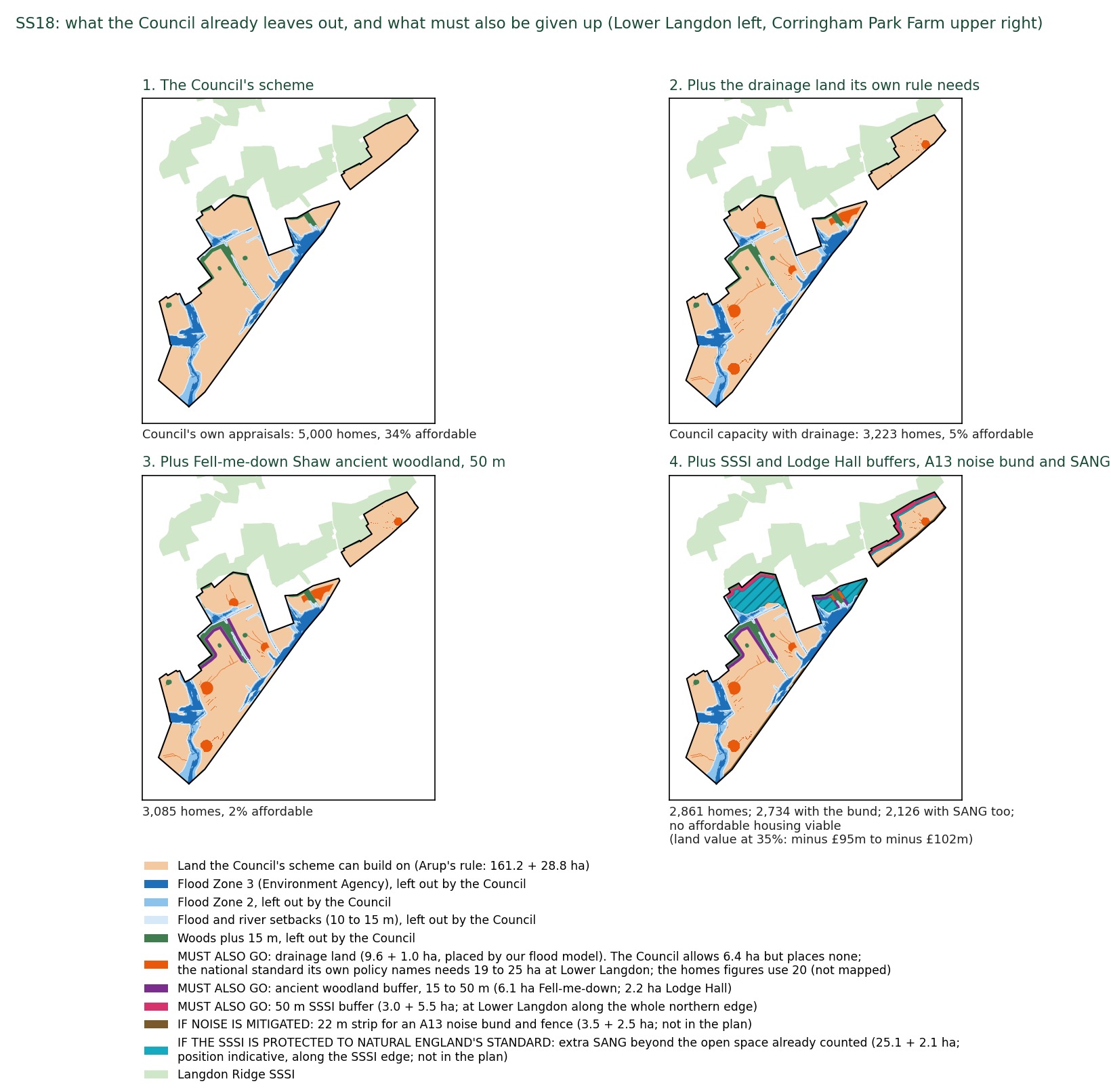
The capacity study was told its figure “must demonstrate capacity exceeding the 4,000-dwelling target”. The Council's own capacity figures give 3,841. Set aside the land its own drainage, SSSI and woodland policies require: 2,861. Add an A13 noise bund and visitor greenspace to Natural England's standard: 2,126.
Unviable on the Council's own figures
Its viability study puts the main parcel's land value at minus £9.8 million and finds the site “unviable” at the 50 per cent affordable housing that Green Belt release requires. Rebuilt to the pound, it supports 17 per cent on the Council's own capacity, and none once the land its own policies require is set aside.
It cannot deliver in time
The promoter told the Council's consultants the site could not deliver in the plan's first five years. If the plan is adopted in 2028, building starts in 2033 at the earliest, yet the Council's trajectory counts 600 homes by 2034. 1,600 of the 5,000 come after the plan ends.
No wildlife survey beside a SSSI
No ecological survey has been published for about 620 acres directly below Langdon Ridge SSSI, inside Natural England's Impact Risk Zone.
The flood evidence is an unapproved draft
It says the floodplain “should be retained as floodplain” and that “detailed modelling should be undertaken”. None has been.
Infrastructure unfunded and unconfirmed
£256.6 million of infrastructure, every item to be paid from developer contributions on a site the Council's own study finds unviable. The A13 junction at Stanford goes over 100 per cent of capacity with only monitoring proposed. 600 square metres of healthcare for about 12,000 people.
Water and sewage not planned for
There is no sewer to the site and none is costed. The only sewage capacity test assessed a different plan, and the detailed study it called for was never produced. No water or sewerage company has confirmed capacity for SS18: there is no statement of common ground, and no water item in its infrastructure schedule.
Beyond the documents: new analysis
Where the Council's evidence left a question open, I ran the analysis myself from published data, so every point rests on figures that can be checked.
- Flood modellingA two-dimensional flood model of the catchment for a 1 in 100 year storm, run before and after development, with and without drainage basins.
- Surface water flow pathsFlow paths traced from 2 m LiDAR terrain, measuring how much upstream land drains through the site.
- Drainage sizingStorm storage and the land it needs, modelled against the land the plan allows for it.
- Land budgetEvery constraint mapped on the land the Council says can be built on: drainage land, ancient woodland and SSSI buffers, an A13 noise bund and SANG.
- Site viabilityThe Council's own viability appraisal rebuilt to the pound, then corrected one assumption at a time.
- Housing need and jobsThe jobs forecast tested against official employment records, and the housing target against 24 years of house-building.
- Water and sewageWater supply and sewage treatment checked against the water companies' plans, the works permit and its spill records.
- Historic mapsEighteenth and nineteenth century maps used to test the age of the woodland next to the site.
- Cat predation and edge effectsThe share of each parcel within cat roaming range (400 m) of the SSSI, measured from the boundaries.
- Replacement land supplyEvery alternative site in the Council's own land availability assessment, matched to the plan.
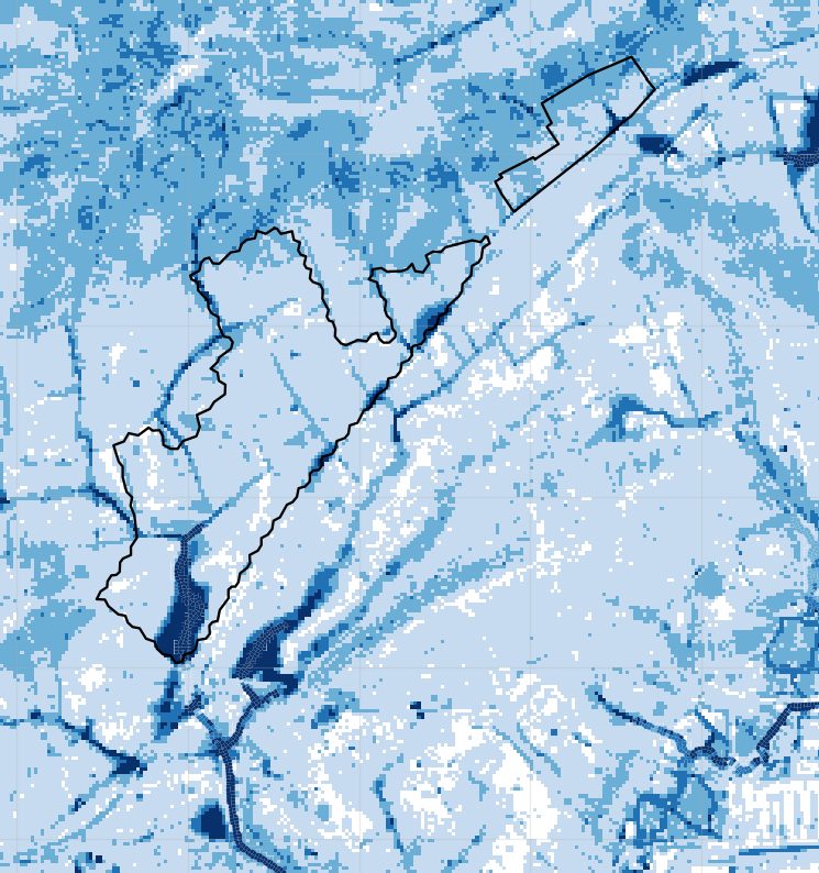
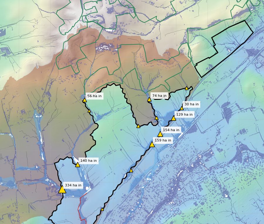
Maps contain Environment Agency and Natural England data © Crown copyright and database right 2026.
5,000 homes on the plan. 2,126 once the land the Council's own evidence requires is set aside
Step by step from the Council's own scheme: the drainage land its own rule needs, a 50 m buffer to Fell-me-down Shaw ancient woodland, then the SSSI and Lodge Hall buffers, an A13 noise bund and Suitable Alternative Natural Greenspace (SANG) to Natural England's standard, shown as the teal band along the SSSI edge.
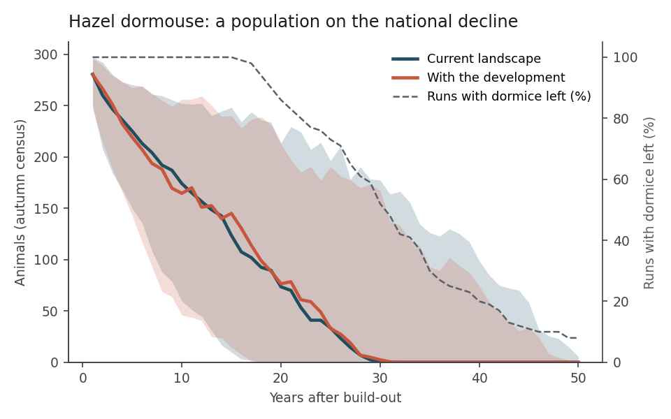
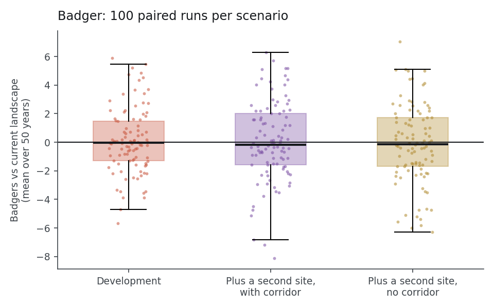
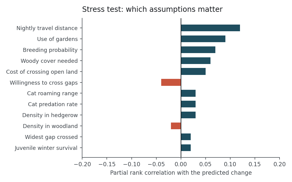
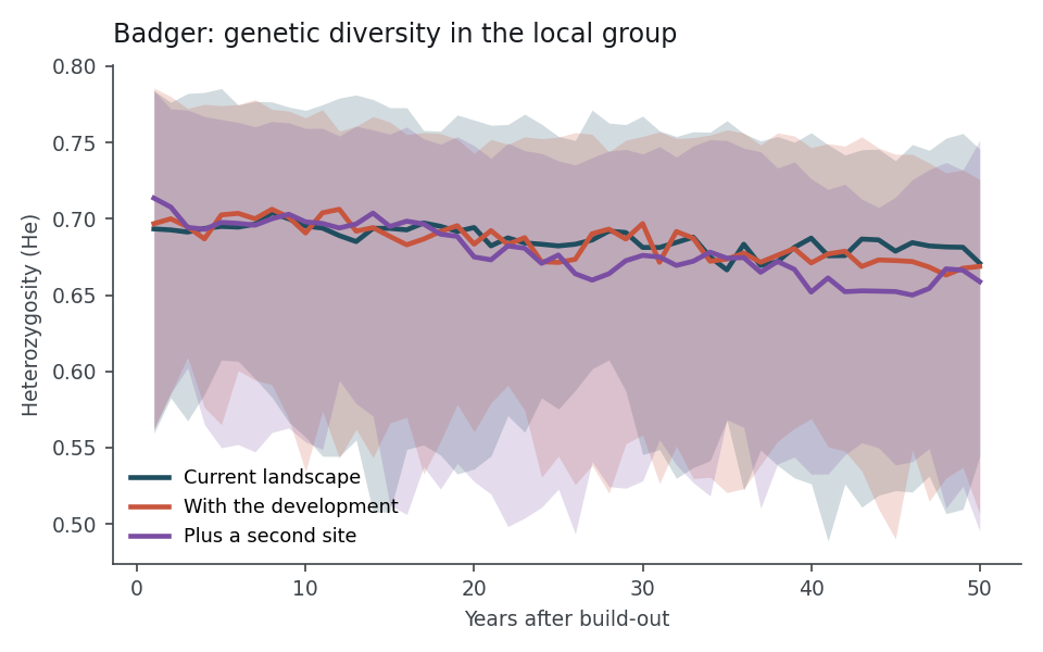
I have built individual-based population models of protected species, including badgers, hazel dormice, hedgehogs and grassland invertebrates, to test how a development would change their numbers and the links between their habitats. Alongside these: nitrogen added to protected grassland by dog walking, and visitor footfall modelling.
Individual-based models: 100 paired runs over 50 years for each scenario (median and 90% range), and a stress test across 200 parameter sets. Site details withheld.
"Petitions and 'save our Green Belt' letters will not work at this stage. Evidence will."
DR JACKIE LIGHTEN, CAMPAIGN LEAD, PROTECT LANGDON NEWSLETTER 1, 20 SEPTEMBER 2026
Nearly 10,000 pages, made clear in under four weeks
The same method works on any complex matter: analyse everything, test every claim against the record, and turn the findings into material each audience can use.
Evidence analysis, not legal advice. Figures from the project's evidence inventory at 26 September 2026. Findings shown are set out in full in our representation on Policy SS18.